Saturday, 29 December 2012

Innocent By-standers

Snow clearing in Montreal is a major financial and physical effort. Woe to the innocent bystanders left along the path of the machines.


Whether they were abandoned by their owners or simply left locked on the sidewalk by people who forgot that winter still exists; it is a sad end for these trusty steeds.


Car-free Day

Cars do have their purposes; especially for visiting family in another city. But the feeling of freedom from bother when returning a rental car is particularly sweet on the day following a record snowfall in Montreal.


Yes, it is clear to see how much more suited a car is to getting around a Canadian city in winter than a bicycle.


Tuesday, 18 December 2012

This is Montreal

What a difference two weeks makes.


I'm sorry, but no amount of publicity and four season boosterism is going to convince me to try and navigate the snowy streets of Montreal on a bicycle. It makes about as much sense as trying to drive a car through these streets.

Besides, walking through the snow as you watch motorists try to barrel their way out of their parking spots is one of the more pleasurable experiences of a Montreal winter.

Many cyclists decide to leave their bikes down on the sidewalks even as the snow piles up. 


I wonder how many survive the passing of the plows and blowers when the city tries to defy nature, and scoops up the tonnes upon tonnes of snow?


Wednesday, 12 December 2012

Navigation 101

Last week, I watched the Fifth Estate's updated report on the Costa Concordia accident, which included an interview with the ship's captain.

http://www.cbc.ca/fifth/2012-2013/2012/12/costa-concordia-the-captains-tale.html

Most of the report is actually made up primarily of portions of the first report that the Fifth Estate broadcast earlier in the year.

Still, it was fascinating and disconcerting to listen to Captain Schettino tell the journalist how the accident really wasn't his fault. He mentions the First Mate, the wheelsman, the company, but only refers to himself as almost a victim of circumstance.

Perhaps if the journalist had referred to the Italian government's preliminary report he might have challenged the captain on some of his assertions.

http://dl.dropbox.com/u/3544291/Italian%20Maritime%20MSC90%20Presentation%20Costa%20Concordia.pdf

As it is, what amazes me is that, if the bridge team had simply followed some of the basic principles of navigation and pilotage, this event would never have happened.

According to the preliminary report, this was the planned route of the vessel:


Even if you know nothing about navigation, common sense dictates that, if you have a hazard on one side of your planned track and open water on the other, you should err on the side of caution and stay in the safe zone.

Still, planning the turn to pass parallel to the island at the point of the nearest danger demonstrated no thought in the planning at all. If the 278 course had been shifted a mile to the south of the course shown on the chart, it would have allowed for the vessel to be turned on to the next course with room to correct even if they had missed the turn.

Additionally, with all the sea room to starboard, there is no reason why the turn could not have been started early and made in a serious of steps, which is not uncommon with a large turn of almost sixty degrees.

These are basic principles followed by prudent navigators throughout the world and throughout history. It is sobering that while technology can help navigators in the performance of their jobs, it cannot save them if they choose to ignore those principles.


Tuesday, 11 December 2012

Wish List

In a shot from the city of Montreal's 2012 cycling map, I've marked three dead ends or missing links that make the top of my wish list for the city to take some action in the new year.


Number 1 is the dead end at the corner of Bellechasse and Boulevard Saint-Laurent, which causes so much frustration for cyclists and pedestrians. For cyclists heading downtown in the morning because they end up at a one way street heading north when they want to head south. And for pedestrians because the majority of the cyclists choose to ride on the sidewalk between Bellechase and Bernard until they can pick up the bike path on Clark.

Number 2 is the missing link between the corner of Esplanade and Mont Royal Avenue and the bike path on Rachel. This is probably the easiest one of the three to address as it merely requires a small widening of the path on the east side of Jeanne Mance Park in order to define a section for cyclists and a section for pedestrians.

Number 3 is the dead end at the intersection of Prince Arthur and Boulevard Saint-Laurent. It seems madness to define an on-road bike lane on Prince Arthur that leads cyclists to one of the busiest commercial streets in the city. Perhaps it was thought that the bike lane would continue on the pedestrian portion of Prince Arthur towards the north/south Berri bike path, but this has not been done so I am not quite sure what the idea is here. 

An option could be to make Clark Street cyclable from Bernard to Prince Arthur, but it would certainly meet with opposition in the narrow southern section that would require parking spaces to be removed. The city's map is somewhat misleading as it does not show streets where there is only one direction of travel for cyclists such as on Saint Urbain (southbound), which gives the impression that it is available to cyclists to go north on it. 

It is fine to ask cyclists to ride responsibly and respect the rules, but it also should be incumbent upon the people who design our urban infrastructure to provide a system that makes sense for the citizens that use it.

Friday, 7 December 2012

Conundrum

One of the problems with the city removing bike lanes in mid-November is what do the cyclists who continue to ride the streets of Montreal do when their normal route has been closed?


Well, they ignore the fact and continue to use the space as if the bike lane was still there.

Though it does present the conundrum of whether to ride along the left or right side of the road since there is no longer any official bike lane. A few minutes viewing will show that some cyclists will choose the left and some will choose the right, though all the cyclists who are now illegally riding against the traffic on this one way street choose the left side where the bike lane used to be.

I wonder if a cyclist has ever been ticketed by the police in the winter for riding the wrong way on a street that for the rest of the year would have been the place a cyclist is expected to use?


Peer Pressure

Off the ship and back in Montreal, I was all set to leave my bike leaning against the wall till the spring. However, as I walked the streets of the Plateau my first morning back, the sight of so my people bravely bundled up and continuing to ride their bicycles on a cold December day was too much to ignore.

Even though it required replacing the rear tube because of a slow leak that had gone completely flat over the month while I was at work, I set to the task and was shortly trundling my two-wheeled liberty down the stairs.

What a reward! The feeling of content as I rode around town on a day stolen from the fourth season was a real pleasure.

As long as the snow holds off, I will hold off storing my bike; happy to succumb to the peer pressure of the increasing number of cyclists who continue to ride after the arbitrary date chosen by the city to close most of the bike lanes.

Sunday, 2 December 2012

Ontario Cycling Death Review

Saturday's Globe and Mail has a piece about the province of Ontario considering legislation for mandatory helmet use for cyclists based upon a recommendation from the provincial Coroner's Review of Ontario Cycling Deaths released in June.

http://www.theglobeandmail.com/news/national/ontario-to-consider-making-bike-helmets-mandatory/article5846776/

The review makes for interesting reading regarding 129 cyclist fatalities in the province over the last six years.

http://www.mcscs.jus.gov.on.ca/stellent/groups/public/@mcscs/@www/@com/documents/webasset/ec159773.pdf

It has also prompted the government of Ontario to develop a "Cycling Strategy" for public comment.

http://news.ontario.ca/mto/en/2012/11/ontario-moves-forward-on-cycling-strategy.html

I find the most interesting aspect of all this reporting and reports is that the media chooses to focus on the issue of mandatory helmet use over all the other recommendations put forward in the review such as improving cycling infrastructure.

One of the most striking, yet unsurprising, statistics mentioned in the review is that in 100 of the 129 fatalities, the cyclist was struck by a motor vehicle. In some cases, the cyclist contributed to the accident, in others it was the driver and, in other cases, it was due to the actions or inactions of both.

Still, this glaring statistic screams for the need for infrastructure that will enhance the safety of cyclists yet the emphasis is once again put on cyclists and the mandatory wearing of helmets.


Thursday, 29 November 2012

American Locks

The St. Lawrence Seaway only has two American Locks in the system located near Cornwall. They are separated by a pool of three miles length with the Eisenhower Lock on the west side and the Snell Lock on the east side.

The pool is wide enough for ships to pass each other without too much trouble. 


The Federal Mayumi takes it easy sliding the wall into Eisenhower as the wind gusts up out of the southwest.


Wednesday, 28 November 2012

Ships that pass in the night

An early evening meeting with the tanker Maria Desgagnes (http://www.marinetraffic.com/ais/shipdetails.aspx?MMSI=316285000) just east of Cornwall on Lake St. Francis.


It is a normal passing where each vessel favours the starboard or right side the channel and the other vessel passes down their port or left sides. Depending on the area or person, it is called passing another ship 'port to port' or 'red to red' because each vessel sees the red sidelight of the other. 


On the Lakes, mariners use the term 'meeting on one whistle' to indicate the same maneouvre since a short blast on the whistle has the meaning 'I am altering my course to starboard'.

Saturday, 24 November 2012

Last Canal Trip

One last view of the Welland Canal as our work will keep us in Lake Ontario and the St. Lawrence until closing. The other crew on the ship will bring it back into Lake Erie at the end of December.

There is a small pool between Lock 7 and the top of the flight locks at Lock 6 East (downbound) and West (upbound).


A ship waiting to go up in Lock 7 will sit at the head of Lock 6 West until the downbound ship has started making its way into the lock.


There will be another several hours before we clear the canal at Port Weller, but at least it is the last one for the season for us. 

Role Reversal

I quite often see people in Montreal walking their dogs while riding a bike. In Port Colborne, it looks like the one getting the exercise is reversed!


Friday, 23 November 2012

Good choice

Many of the locks in the Welland Canal have a bascule bridge at one or both ends of a lock. Lock 8 has a bridge at both ends. One of the line handlers at the lock has to go to the end of the lock to operate the mechanism to open and close the bridge. Most choose the provided golf cart to make the trek from the centre of the lock, but there was another option at Lock 8.


It was heartening to see that the Lock Master made the better choice.


Wednesday, 21 November 2012

Abandoned Lighthouse looking good

Although the chart identifies Point Abino lighthouse, between Port Colborne and the Niagara River entrance on Lake Erie as abandoned, the local Preservation Society has done an excellent job in making it look anything but.

http://www.palps.ca/about.php

There is no longer a light that shines from the structure. A light buoy is placed just south of the point to mark the shoal that extends 2,500 feet offshore.


A calm day is definitely required as the buoy is very close to the shoal and there is only 21 feet of water at the buoy position giving only 5 feet of clearance between the bottom of the ship and the lake bottom.


Shipbreaking in Canada

Most people only hear about shipbreaking in reference to Alang, India or Chittagong, Bangladesh and the pictures of men working amongst the beached hulks.


Canada, however, has a major shipbreaking yard in Port Colborne, Ontario at the southern end of the Welland Canal.


http://www.marinerecycling.ca/

With facilities in Canada, it is hard to fathom how it can be more economical to tow ships half way around the world to be broken up when, in theory, owners are still required to comply with all the environmental regulations regarding removal of hazardous substances on a ship before it is dismantled.

Even though it is good for the environment to recycle the thousands of tonnes of steel and other materials from a ship, it is somewhat sad to pass these former vessels as they slowly vanish.


This small red-hulled vessel who hasn't yet met her fate is the former CCGS Verendrye. She spent many years sailing out of Sault Ste. Marie, Ontario before being decommissioned and sold over twenty years ago. Since then, she has hung around various locations on the Lakes before coming to her final resting place in Port Colborne.


Monday, 19 November 2012

On the Level

The traffic in the canal cleared out over night, and we left Thorold just before sunrise to head for Lock 8. Between Locks 7 and 8, there is a distance of about 14 miles. From Lock 7 to Port Robinson, there is only one way traffic. Above Port Robinson, the canal widens sufficiently to allow ships to pass each other, just.


This section of the Welland Canal between Port Robinson and Ramey's Bend, just before Lock 8, is known colloquially as "The Level". Traffic controllers advise ships when they will meet another ship 'on the Level'.


As a relatively smaller vessel, we tend to give Lakers more room when passing. However, if you alter too soon or give too much room, the other ship could have a tendency to stay in the center of the channel and crowd your ship over towards the bank. So, you want to make sure you maintain ownership of your half of the channel.

With another calm day, this meeting was a breeze.


Saturday, 17 November 2012

Another Welland Canal Transit

Another calm day in the 'Ditch', but a previous night's fog brought traffic to a halt for a few hours so it was slow going.


Foreign vessels are required to carry a pilot through the canal so a pilot boat is stationed at Port Weller and another at Port Colborne.

Windmill parts are still a popular cargo into the Great Lakes.


Like most modern 'Salties', this vessel has an automatic launching davit for its lifeboat.


I would be less thrilled trying to launch its small rescue boat in any kind of weather so close to the stern.

By sundown, we had only made it as far as Lock 5.


After Lock 7, we decided to call it a day and secure at a berth while ships were still lining up for the lock.


Friday, 16 November 2012

Burlington by bike

The ship berths in Hamilton harbour just by the canal on the Burlington side. Ontario's Waterfront Trail is a minute away following the shoreline.


This section of the trail is very pleasant because it actually is a trail and you can actually see the waterfront.


The trail becomes a boardwalk at Spenser Smith Park as you leave Beachway Park and enter the city.


The city of Burlington has a detailed web page on their site dedicated to cycling infrastructure activities including a Cycling Master Plan:

http://cms.burlington.ca/Page7901.aspx


Hamilton Harbour

The weather buoys we lifted for the winter are unloaded in Hamilton harbour, one of the busiest Canadian ports on the Great Lakes.


Access to the harbour is via a lift bridge in the middle of a short canal that passes under the Burlington Skyway. Needless to say, it can be a source of frustration for local commuters when a ship enters or leaves the harbour during rush hour.


The lift bridge is only the latest in a series of bridges throughout the history of the harbour.

Circa 1898

As is often the case with navigation lights and buoys, ships will sometimes run into bridges as was the case in 1952:

http://henleyshamilton1.wordpress.com/2012/09/14/bascule-bridge-beginning-and-ending/


The Coast Guard does not have a dock in the harbour, but we are given berthing privileges at the Canadian Centre for Inland Waters since we provide the ships that scientists use for their research on the health of the Great Lakes ecosystem.


Needy Montrealer

Snapped this shot from the train on my cell phone leaving the Gare Centrale station on the way to join my ship.


Graffiti artists are looking for attention, but this one seems to be sending a message that can be read from space. 

Thursday, 15 November 2012

Night moves

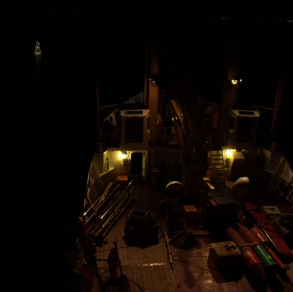
The shorter days mean another weather buoy (although the proper term is an ODAS-Ocean Data Acquisition System buoy) recovered in darkness. Fortunately, we have good quality flood lights to illuminate the deck. 

The calm weather is holding out for another day thanks to a big high pressure system. We try to avoid handling these buoys in rough weather as there are thousands of dollars of delicate equipment on each of these buoys that could get wiped out if they swing the wrong way and strike the ship.


The weather buoys provide wind, air and water temperature, barometric pressure and wave height, which is transmitted via satellite to Environment Canada. Anyone can access this information via their website on the Marine Forecast page.


With the buoy, its 450 feet of mooring chain and 5000 pound cement anchor safely on deck, it is time to head to port to unload so the buoys can be serviced and ready to be deployed again next spring.