Once you get through the streets of Chambly, the path follows the Bassin for a short section and then connects onto the path that follows the Chambly Canal towards St-Jean-sur-Richilieu.

As I was only doing a day trip, I stopped around bridge 4 but I could not help taking a picture of an unusual bird 'condo'.

My return trip had me zig-zagging around the construction again so that by the time I got to St. Lambert lock the bridge was up for a passing ship.

Perhaps this was Karma for last October when I came through the lock on my ship, but I certainly did not make cyclists wait an hour before I entered the lock.
It is hard to fathom why the Seaway needs to close the bike path and raise the bridge so much in advance of an arriving ship. Their explanation leaves a lot to be desired.

It seems to make no sense; open the bridge 45 minutes before the ship arrives because it takes over a mile to stop the ship in an emergency?! Ships are only travelling at six knots in the South Shore Canal and then they would be slowing down to under three knots as they make for the approach wall. Once on the wall, a ship is normally moving at a knot to a knot and a half.
It would probably be more helpful if there was a poster explaining the process of a ship entering and securing in the lock to show why they have to wait until the ship is secured in the lock with the gates closed before the bridge is lowered again.
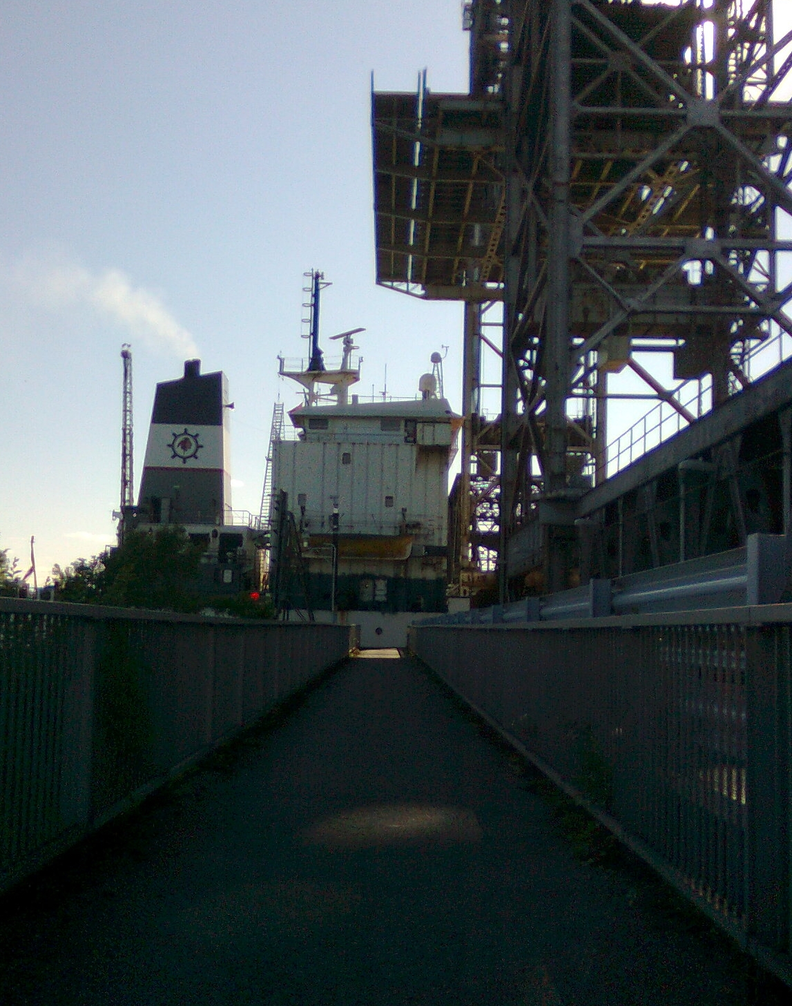
Thirty minutes later, the ship called the Kaministiqua, finally starts to approach the lock.


I'm not sure what the responsibility is regarding control of the bike path section of the bridge since it is Seaway property, but the system is very inefficient. A security guard sits in a booth and has to lock/unlock the gates at either end of the path before and after each bridge opening/closing. So, you have the unusual sight of a person walking across the bridge, key in hand, as dozens of cyclists trail behind until the other gate is opened.
Surely, an organization such as the Seaway, which has automated almost every function in its system, could come up with a better arrangement for opening and closing these barriers?
They do, however, provide information on their website about ship movements http://www.greatlakes-seaway.com/en/navigating/map/index_mlo.html and bridge status http://www.greatlakes-seaway.com/R2/jsp/R2.jsp?language=E&loc=MaiBrdgStatus.jsp (Bridge 3-Upper St Lambert Lock is the one you are interested in).
What with the construction and the bridge roulette it might be another four years before I see the South Shore again!
No comments:
Post a Comment